


Farmers ravaged by war in Ukraine are turning to satellites to maximize yields on the backdrop of massive shortages in resources from fertilizer to seeds. Such an approach was commonly used by governments to gain a strategic edge on the battlefield. As climate uncertainty, population growth, and disruption increase, this is becoming a compelling test case.
Ukraine has been a special focus for OneSoil, as well as an exemplary test case for the technology’s ability to help in truly dire circumstances.
As part of its commitment to providing free services to every farm on Earth, OneSoil is actively working with Ukrainian producers to provide eye-in-the-sky visual precision agricultural images. In hope of benefiting from increasing yields and promoting sustainable farming, the technology has been enthusiastically adopted by Ukrainian farmers in the hopes of averting disaster.
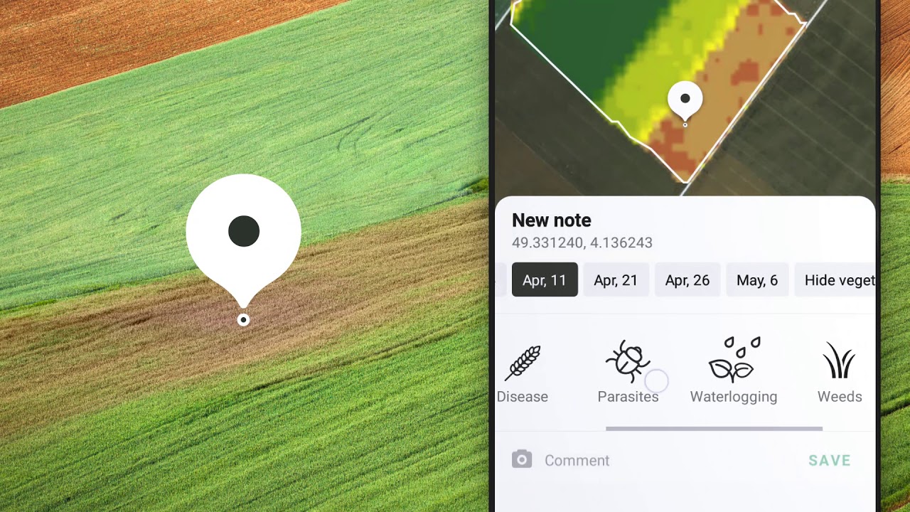
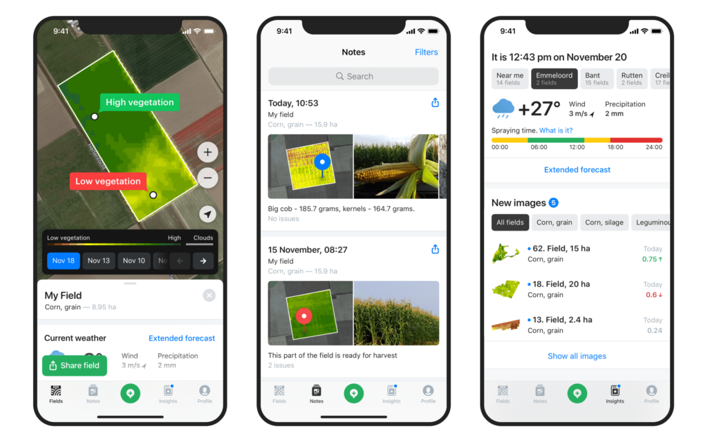
By gaining better visibility through satellite images, farmers can monitor crops remotely, detect field problems quickly, work with productivity zones, and apply variable-rate fertilizers and seeds.
“OneSoil is strongly connected to Ukraine,” OneSoil CEO Morten Schmidt said. The invasion of Ukraine forced OneSoil to leave Minsk and move to Poland. “We created and validated our technologies in cooperation with Ukrainian partners. The ground truth data used to train our models was initially sourced from agricultural partners such as IMC, one of the top 10 largest Ukrainian holdings. OneSoil app is used by more than 50K users in Ukraine, and we continue to closely monitor the situation.”
Due to the war, farmers have experienced a shortage of all the inputs they need to produce their crops, such as fertilizers, seeds, and chemicals. Data from satellites and other sources is used to interpret how and when crops are likely to thrive, allowing redistributing scarce resources more efficiently.
Using satellite data, IMC can calculate how much it could save by redistributing fertilizers between different productivity zones. This was done by reducing the rate in some fields while raising it in others. This results in lowering input costs and increasing profits by redistributing fertilizers between different productivity zones.
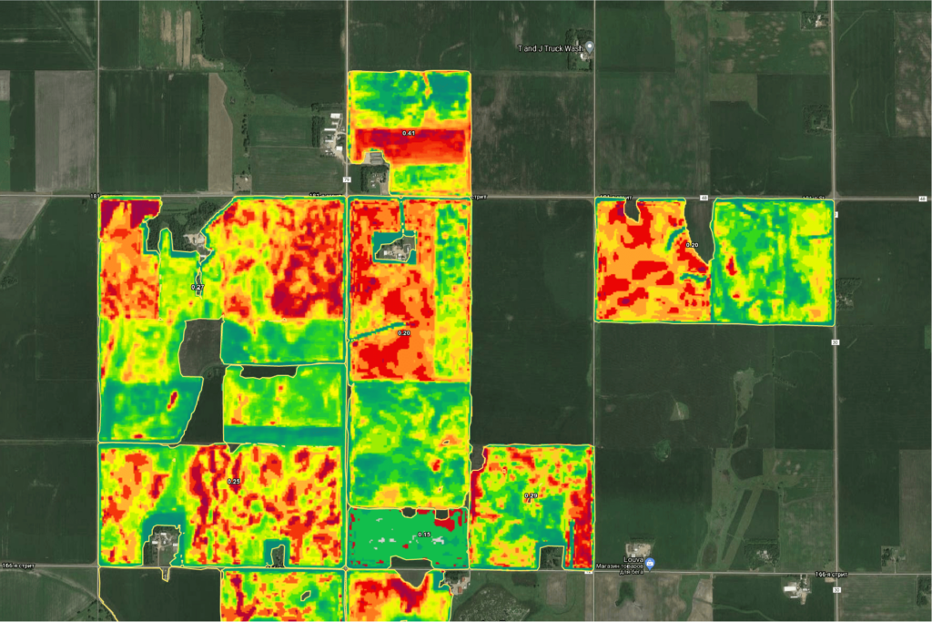
Following the adoption, the average profit per hectare is said to have increased by $32 in 2021. This year they have already used variable rate application of fertilizers on 25,000 hectares.
By comparing the size of crops this year to last year, OneSoil is in a unique position as a data analyzing center to assess the impact of the crisis through its satellite data and machine learning. Following the war, the area under corn and sunflower has decreased by 40% on average in the war zone. This has been replaced by crops that will provide food and security in the coming year, such as buckwheat. Also, the presence of mines and unexploded artillery has prevented farmers from harvesting crops from these fields.
Even though satellite images do not provide these details because current technology was not designed for warfare, such a development is a significant milestone in further enhancement of agricultural practices in hard-to-reach areas.


